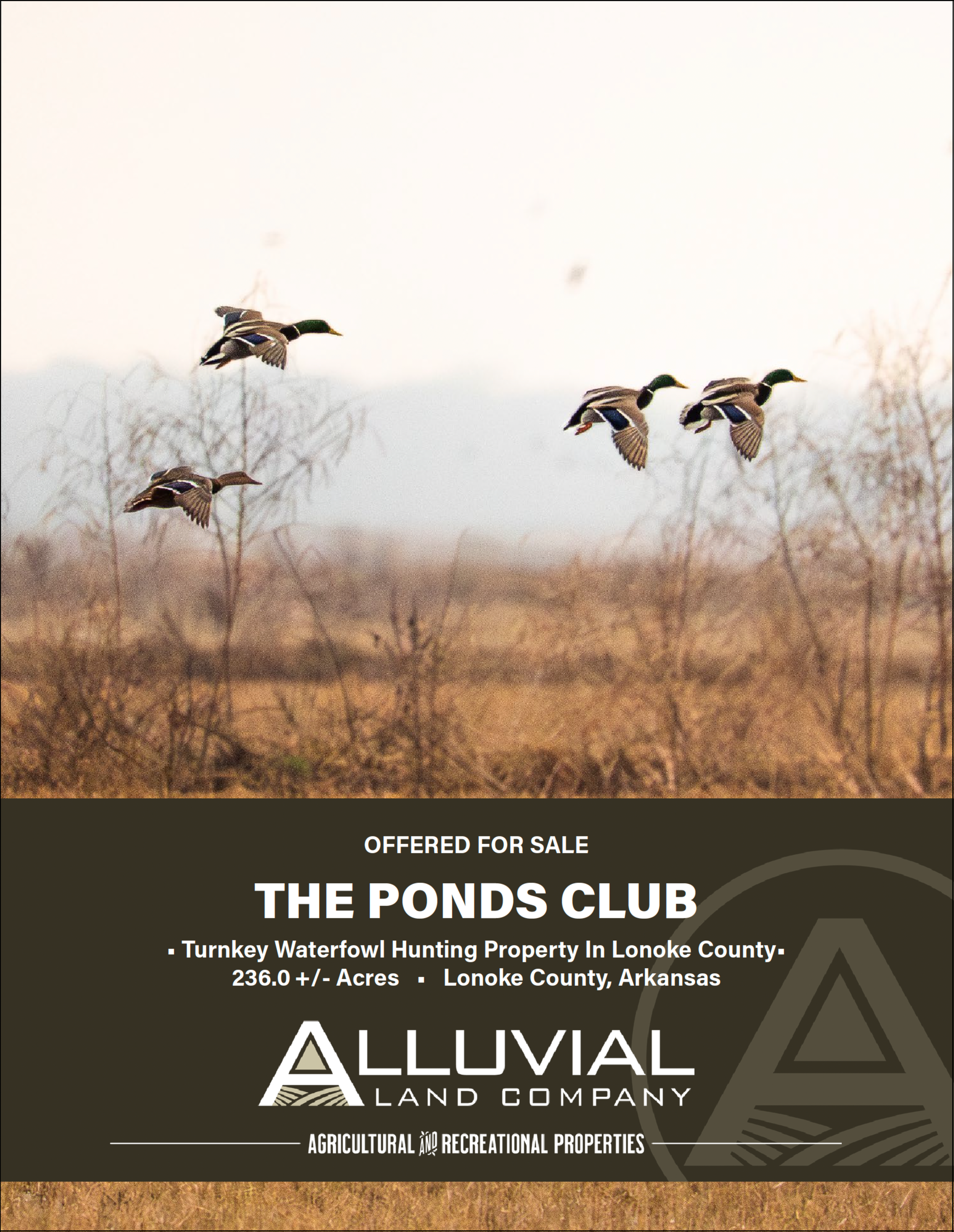
THE PONDS CLUB
OFFERED FOR SALE
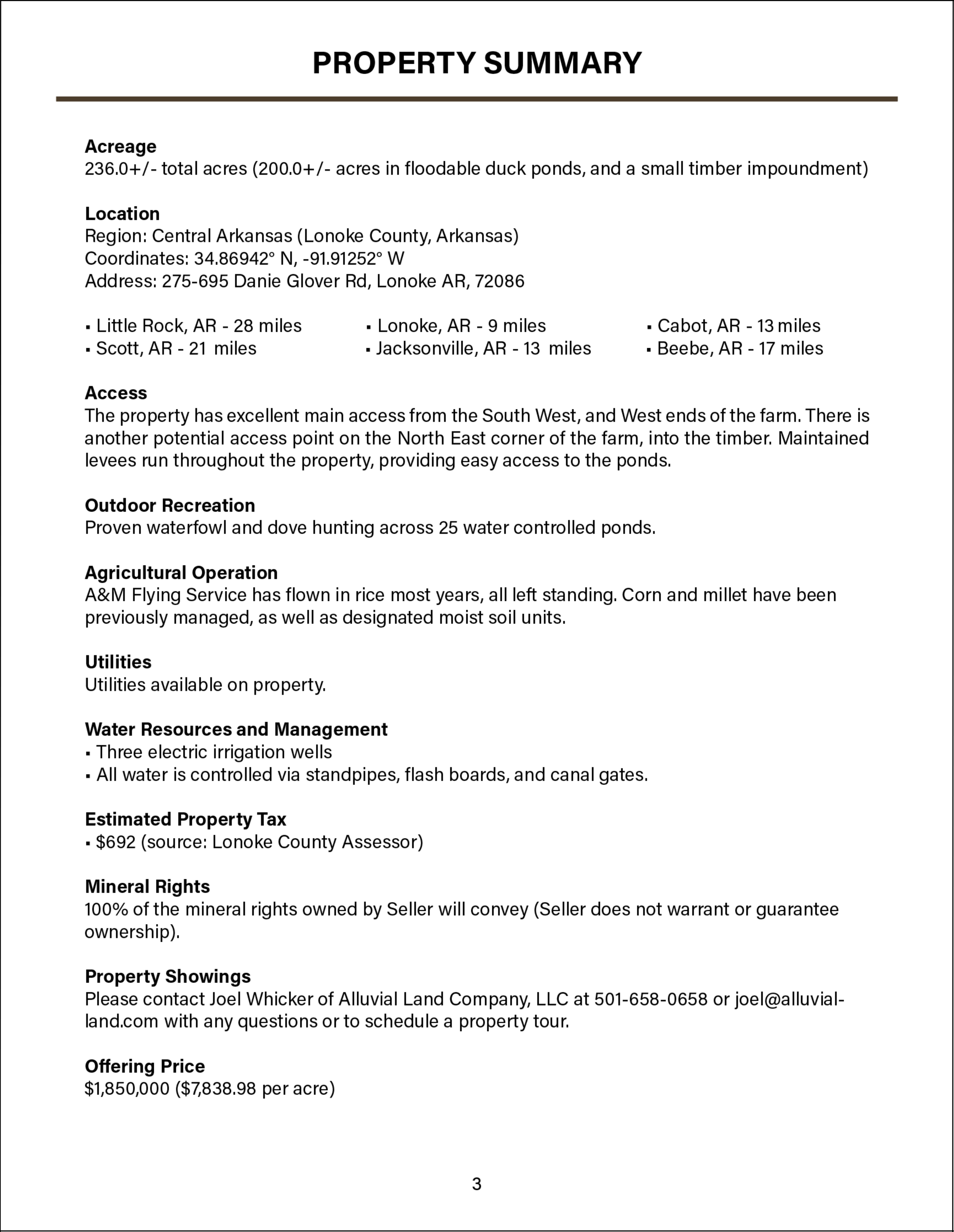
236.0 +/- Acres • Lonoke County, Arkansas
• Turnkey Waterfowl Hunting Property In Lonoke County •
Price: $1,850,000.00
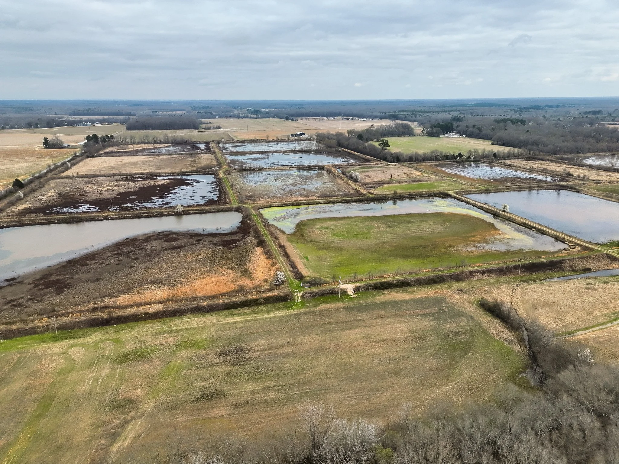
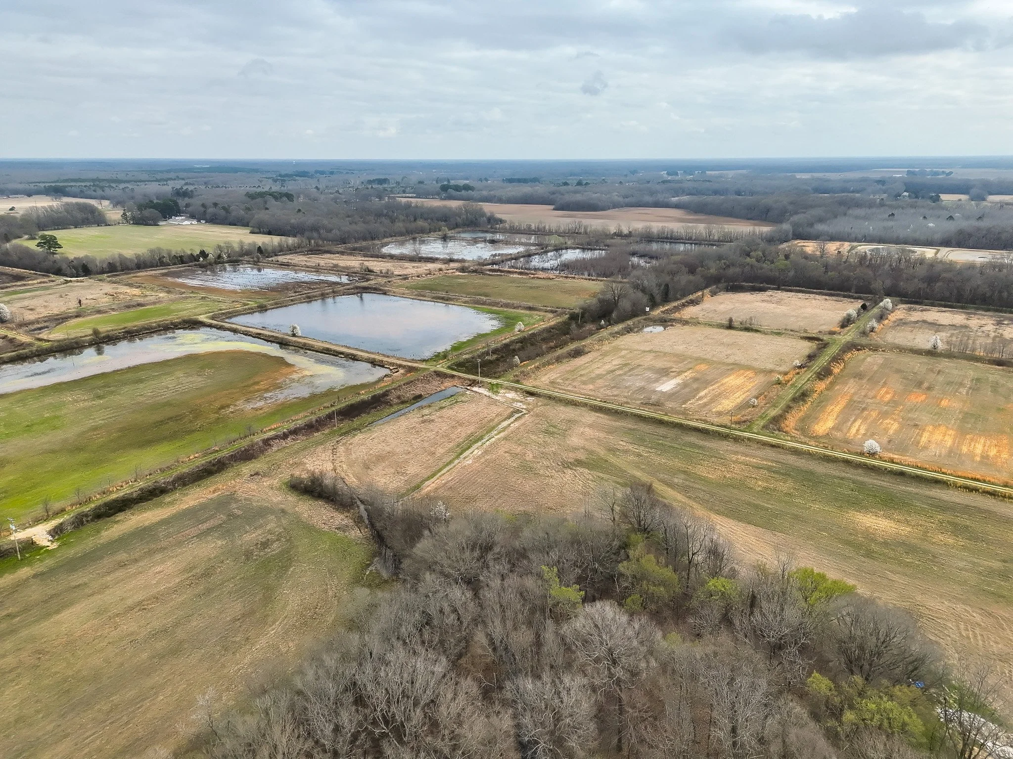
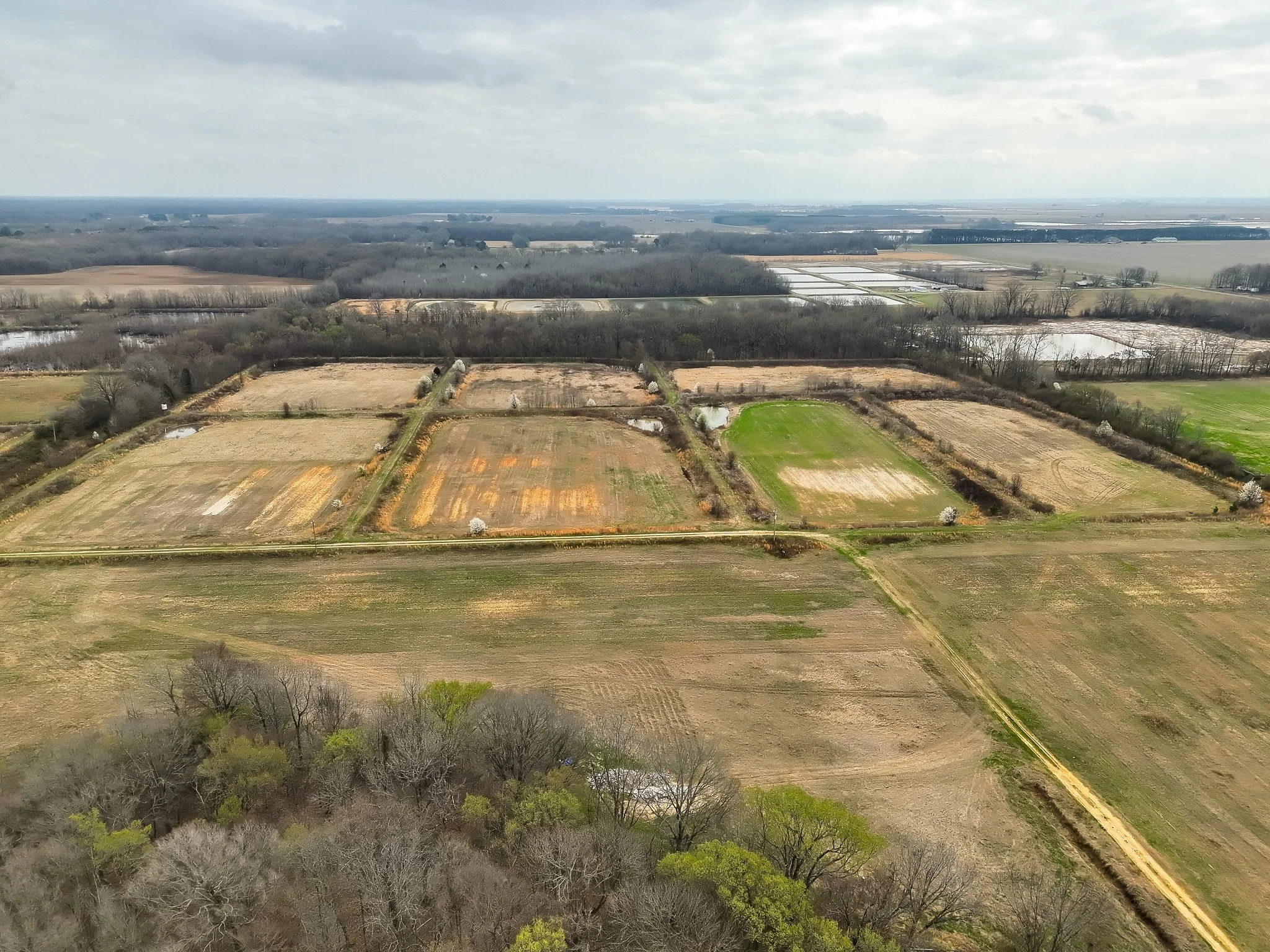
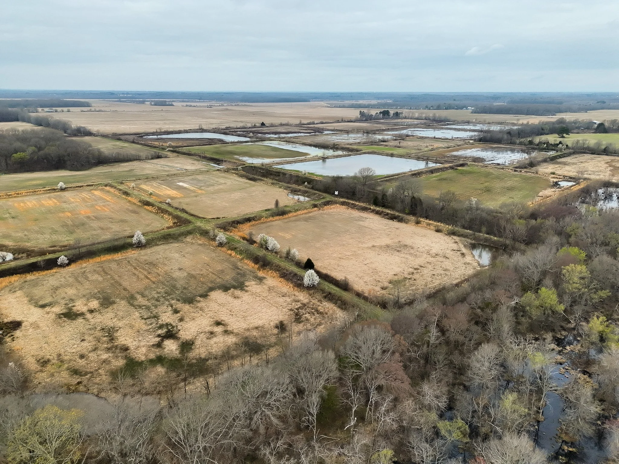
This 236± acre recreational farm in Lonoke County has been developed and managed for waterfowl hunting with established infrastructure and a documented harvest history.
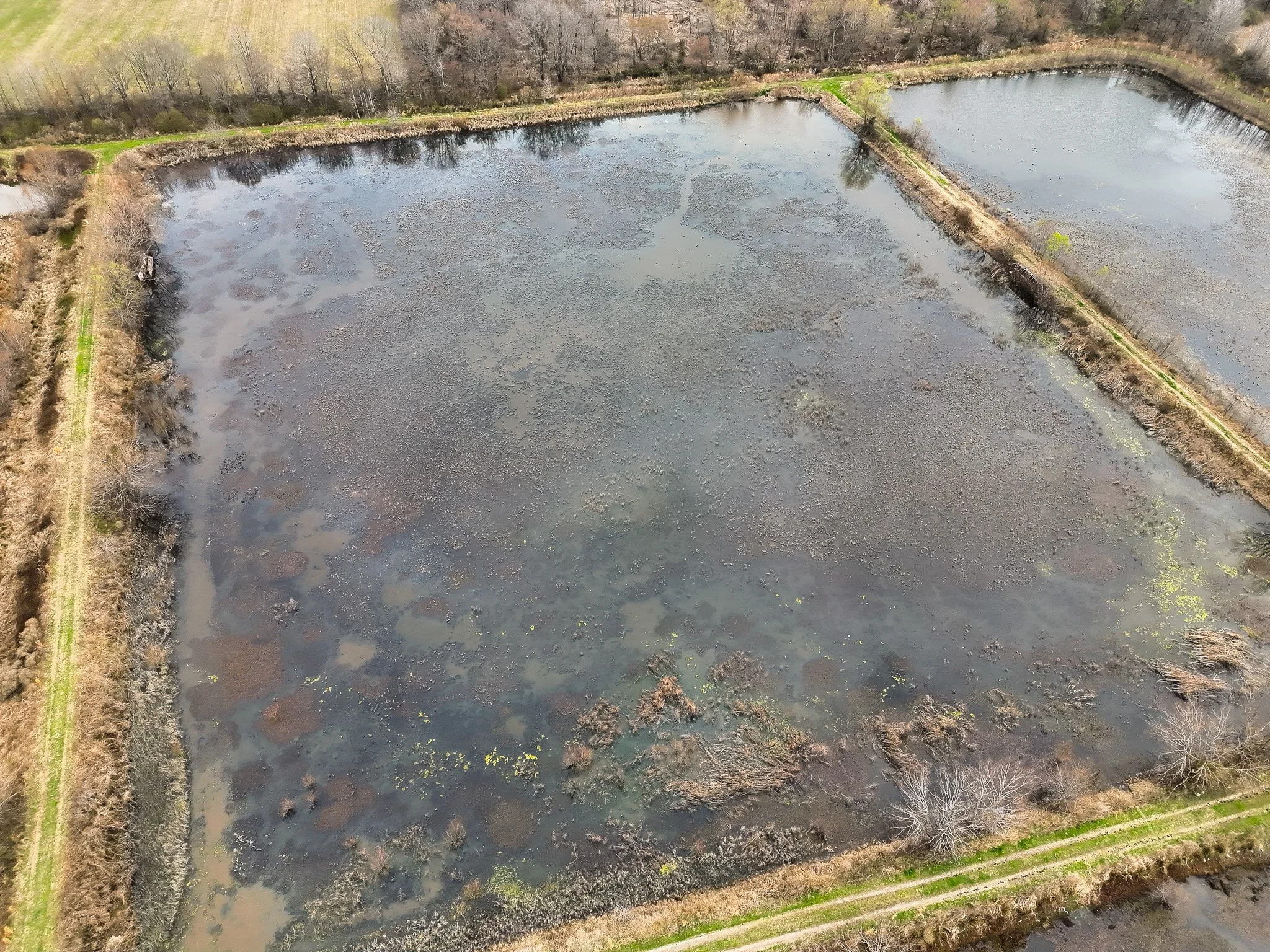
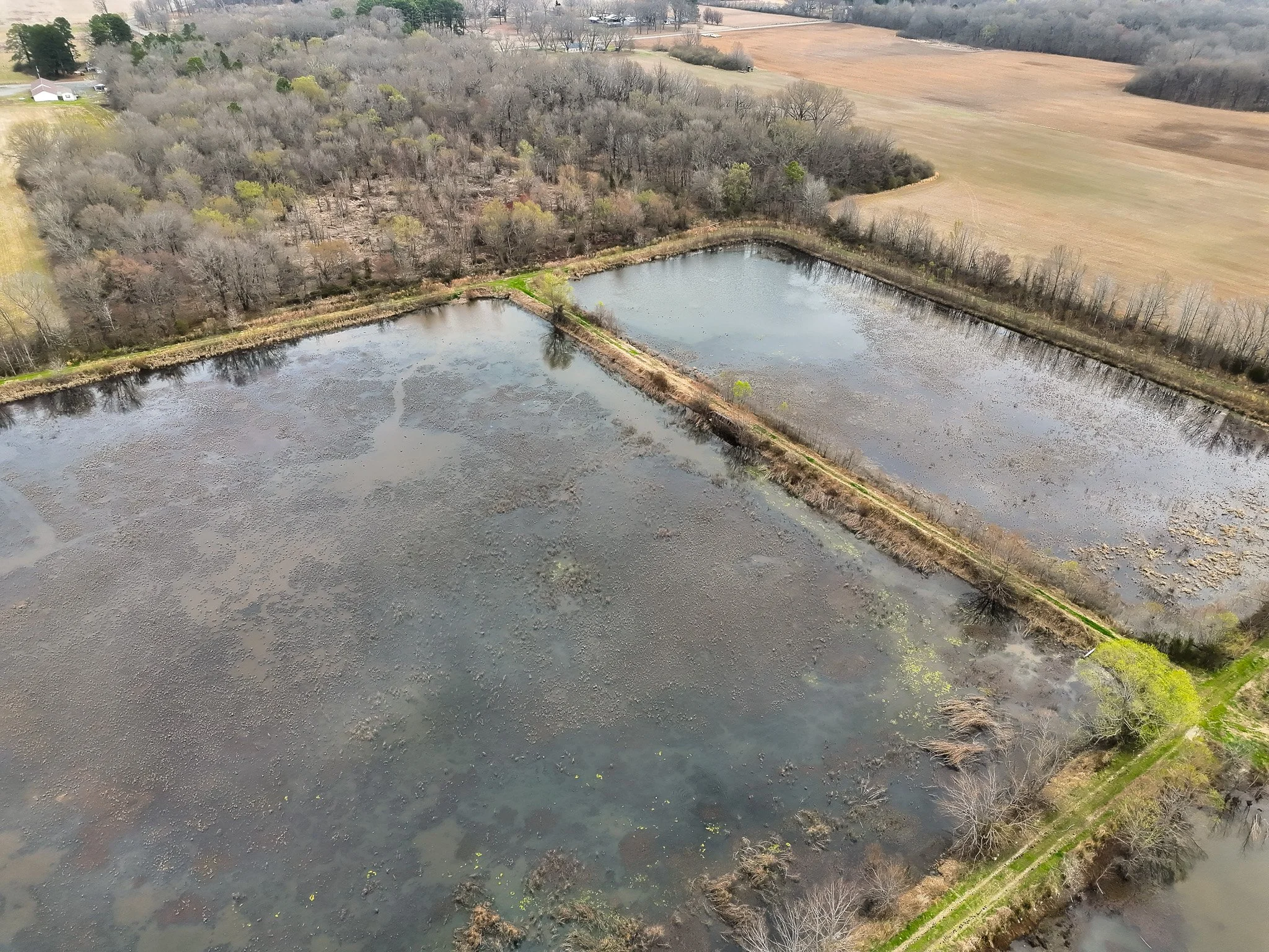
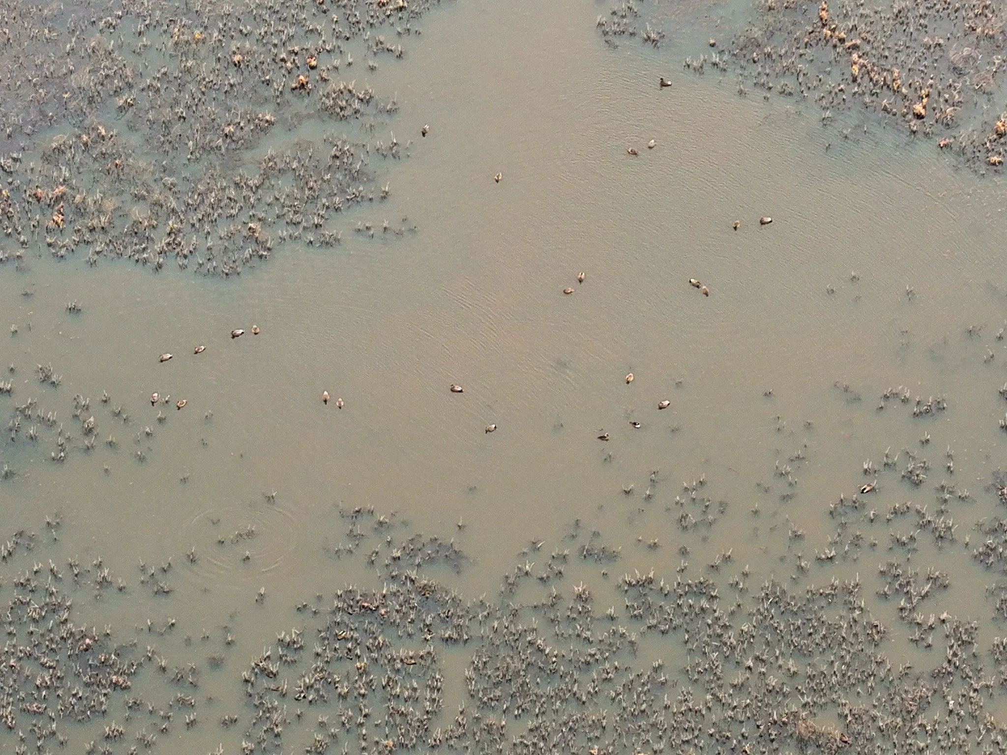
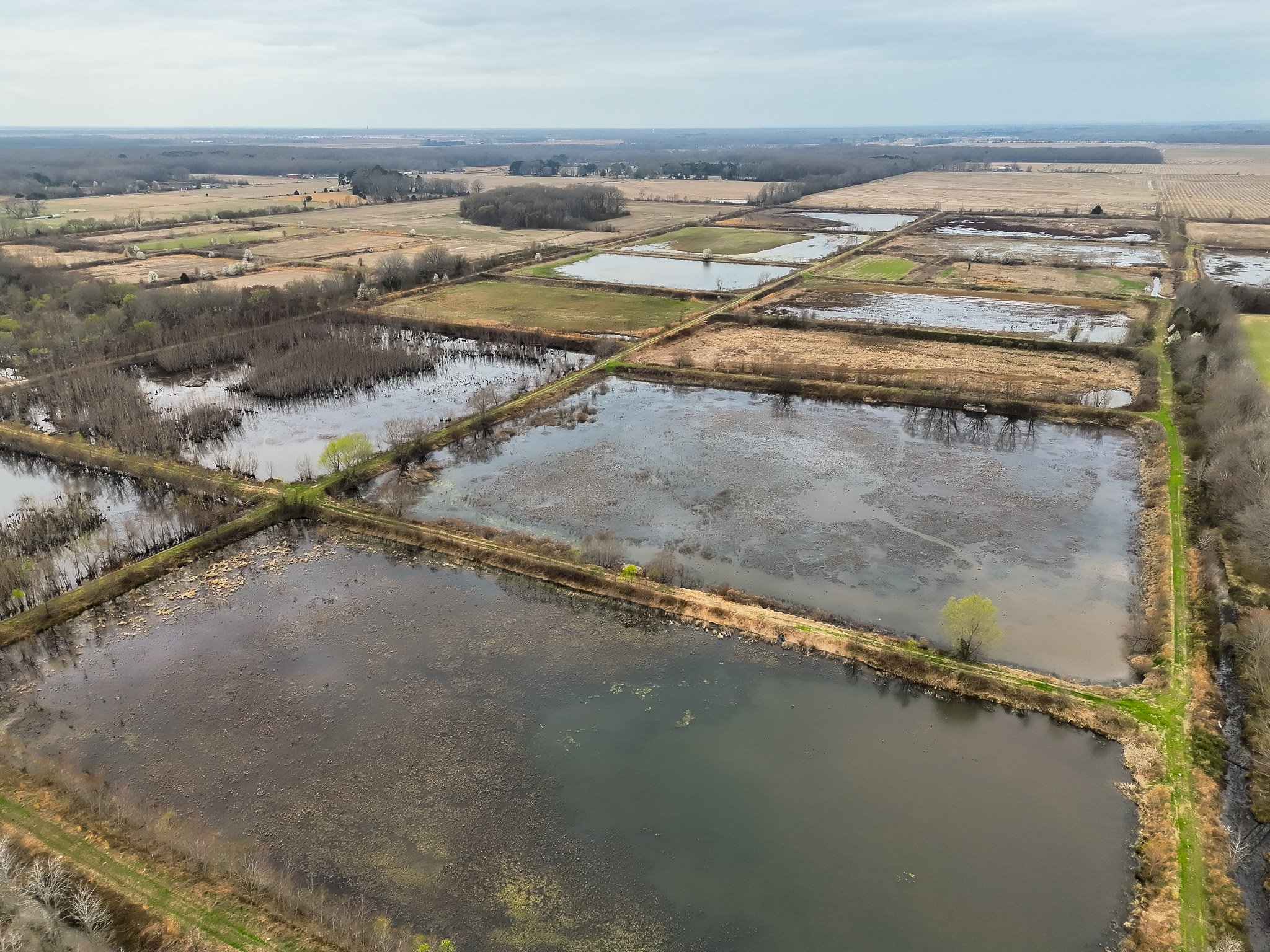
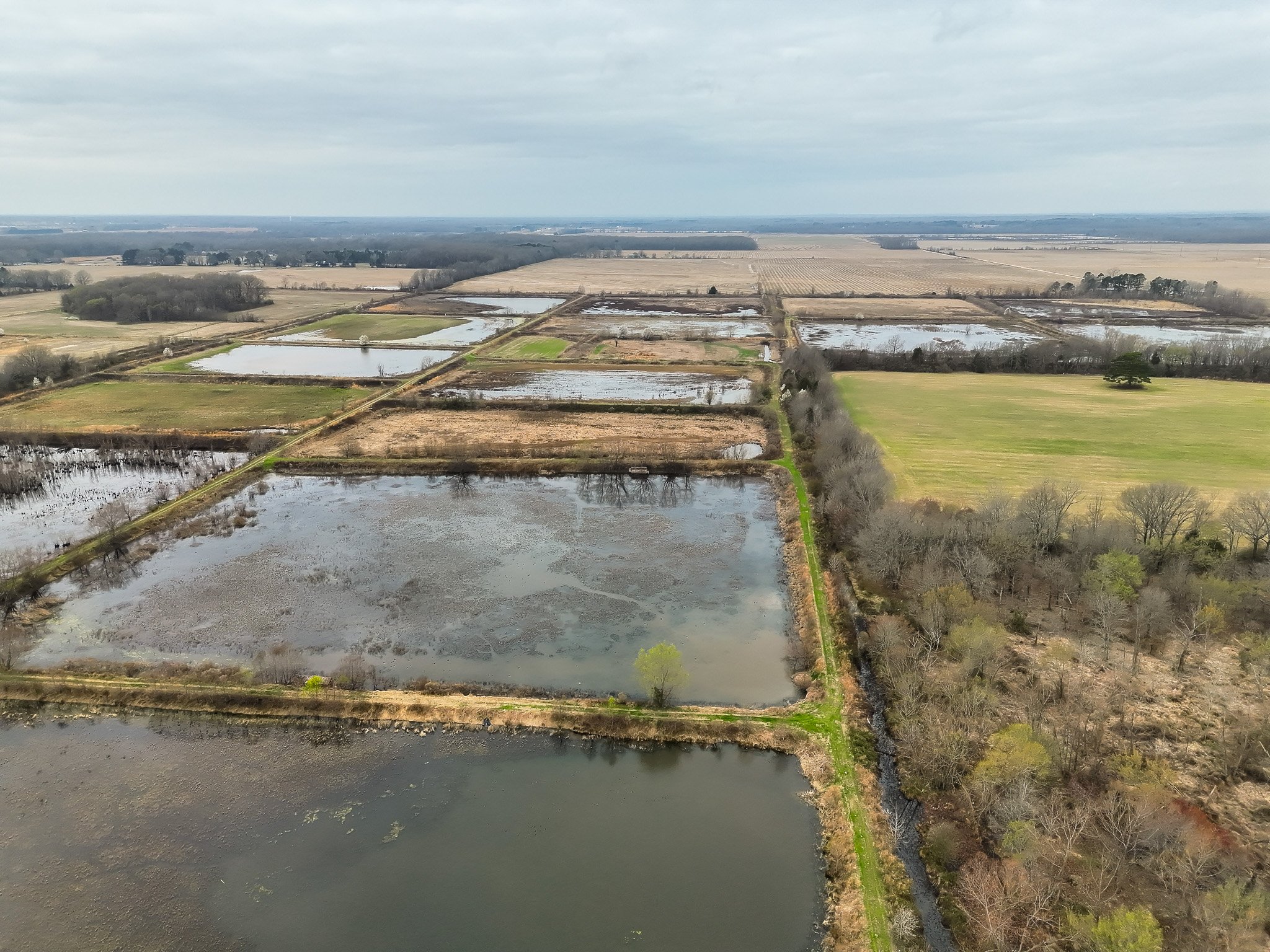
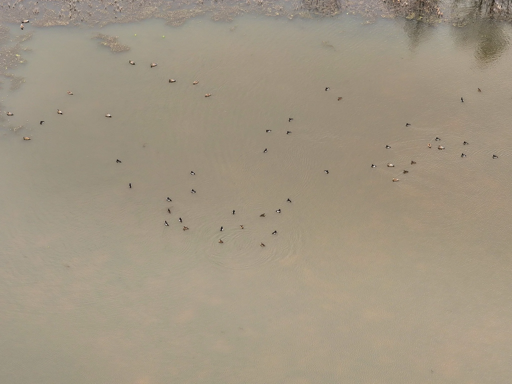
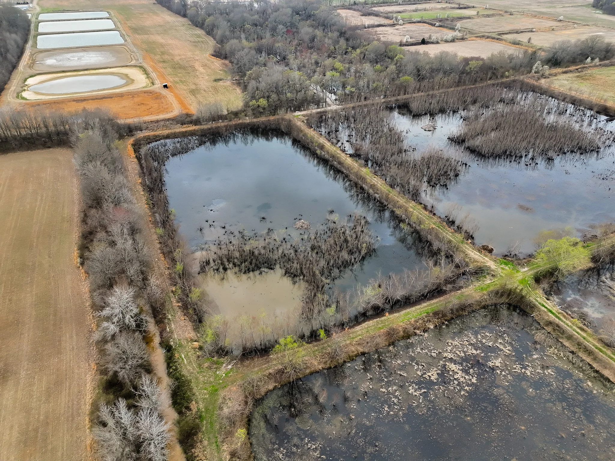
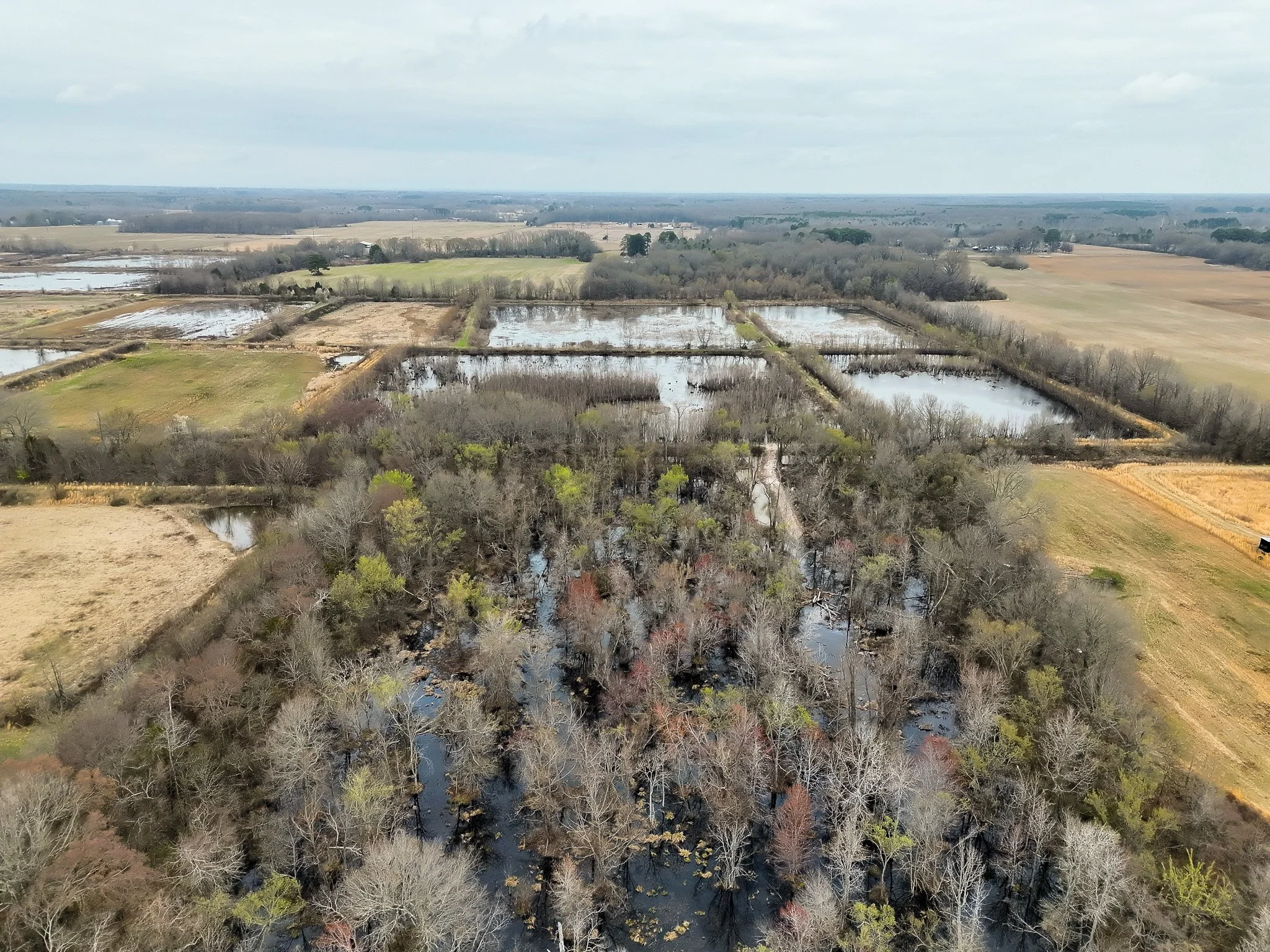
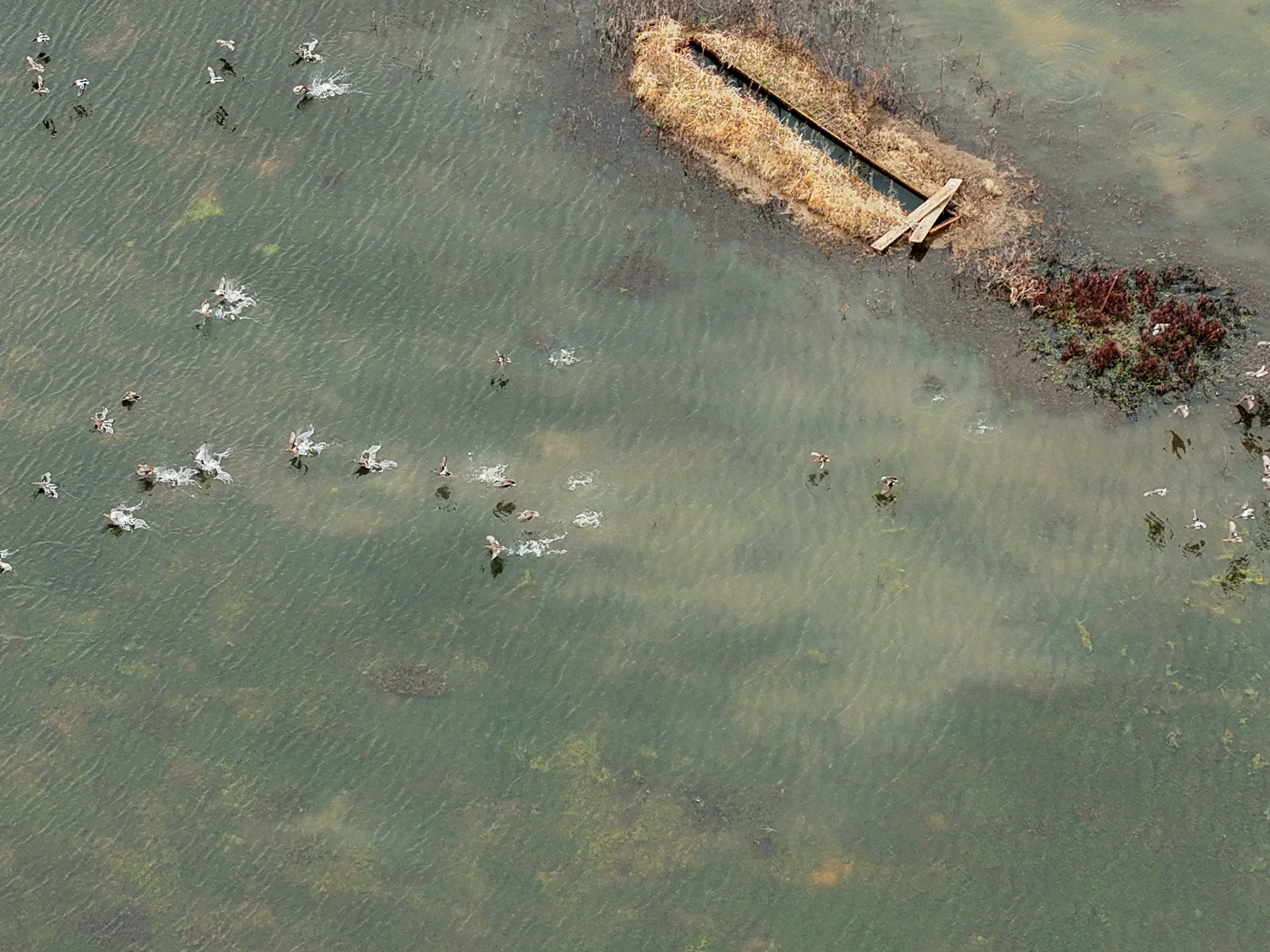
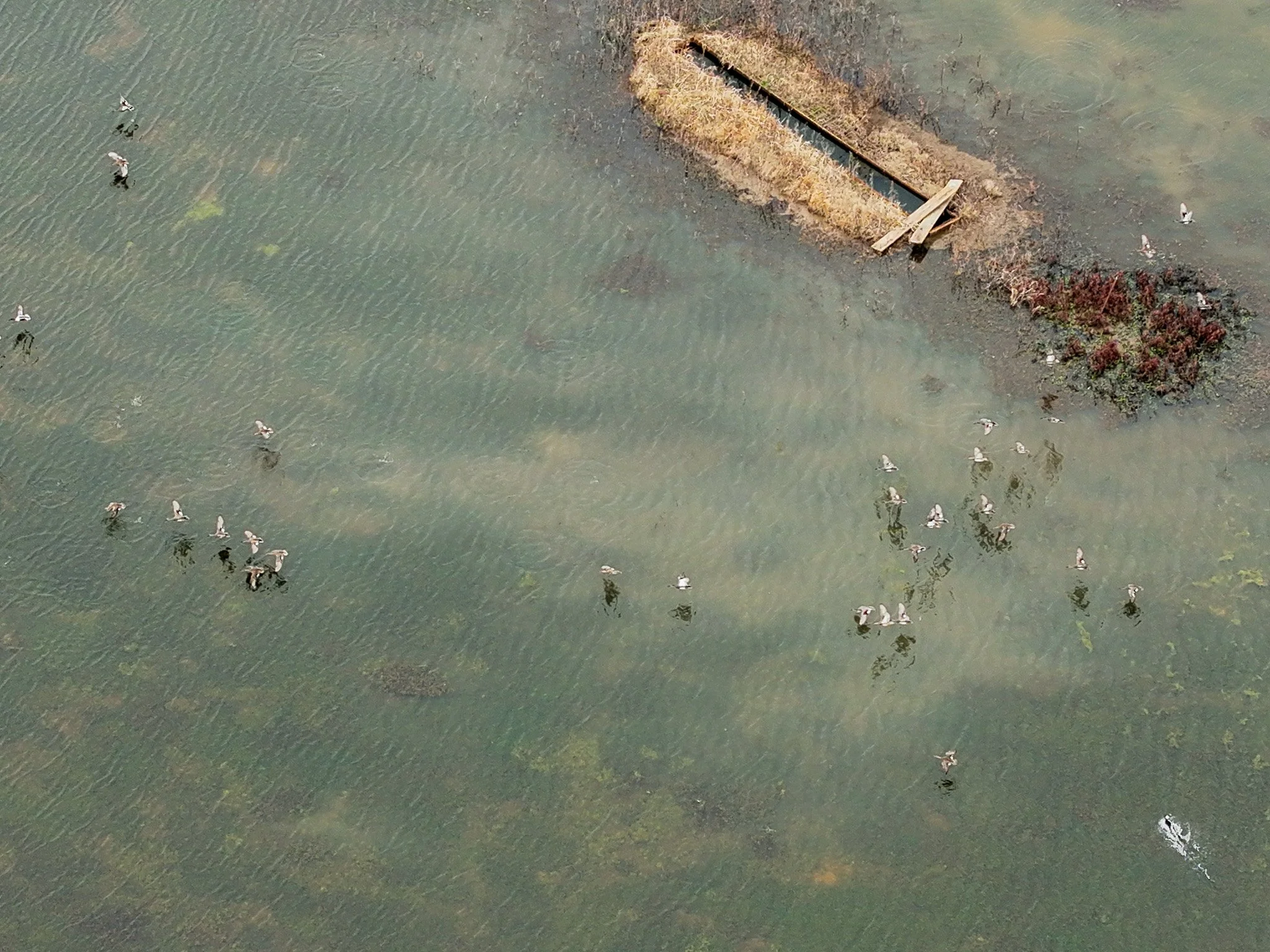
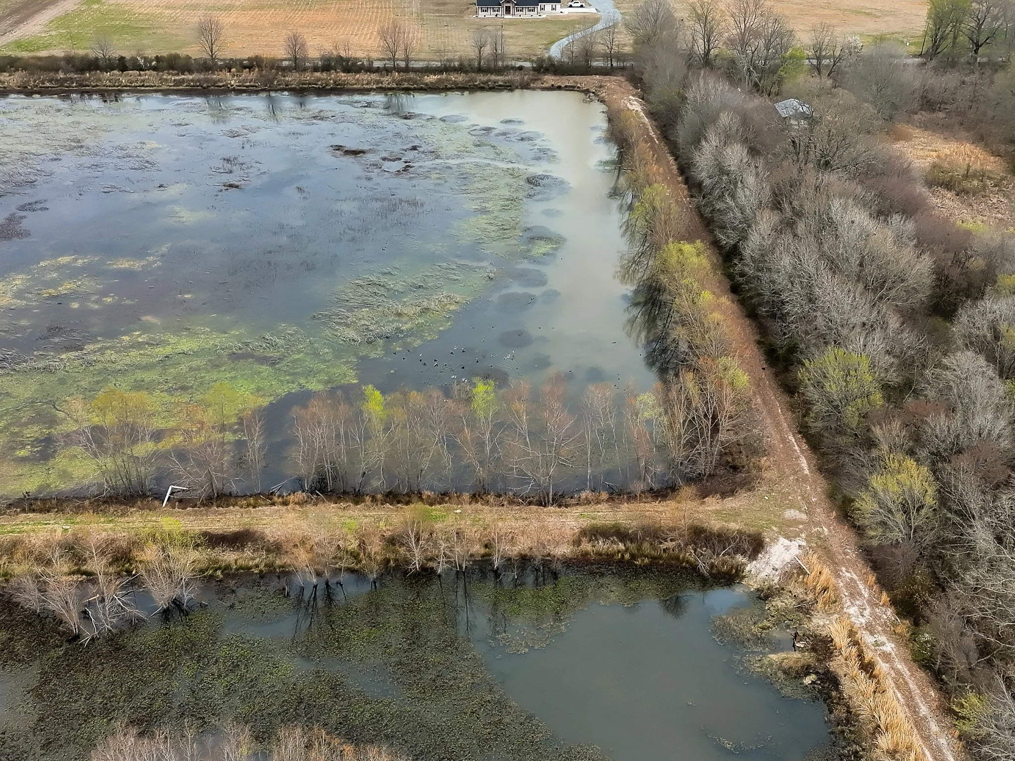
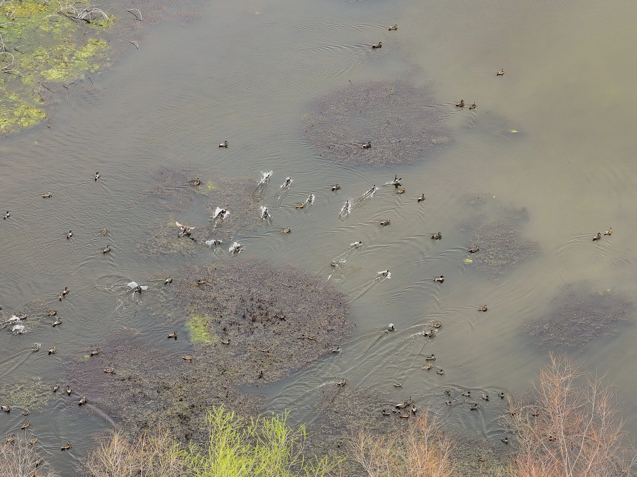
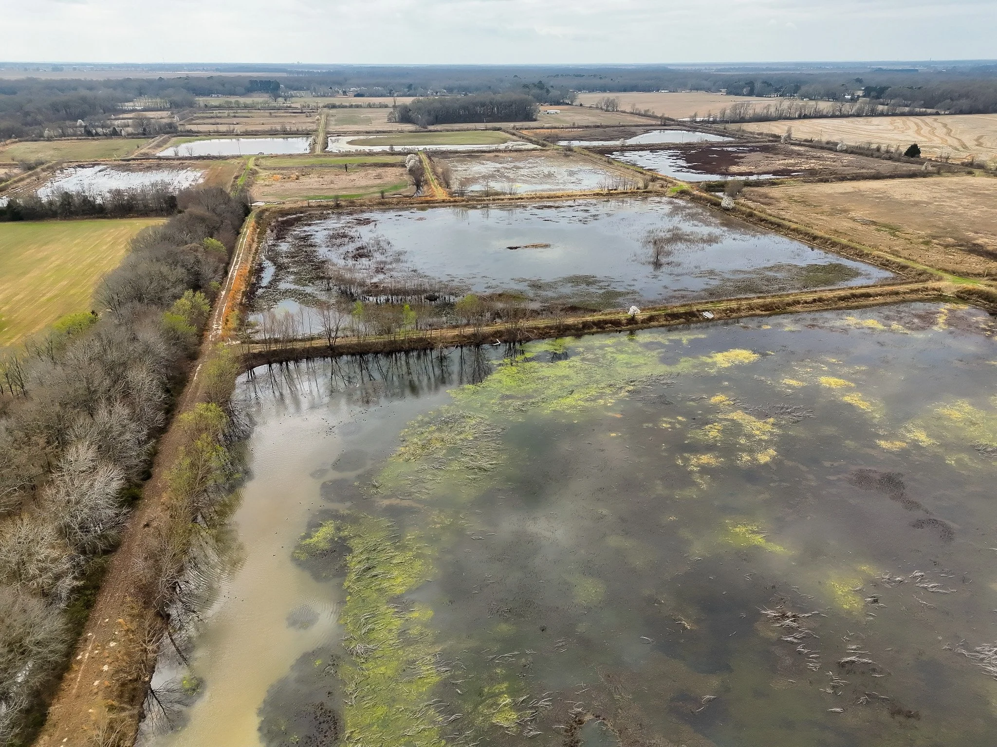
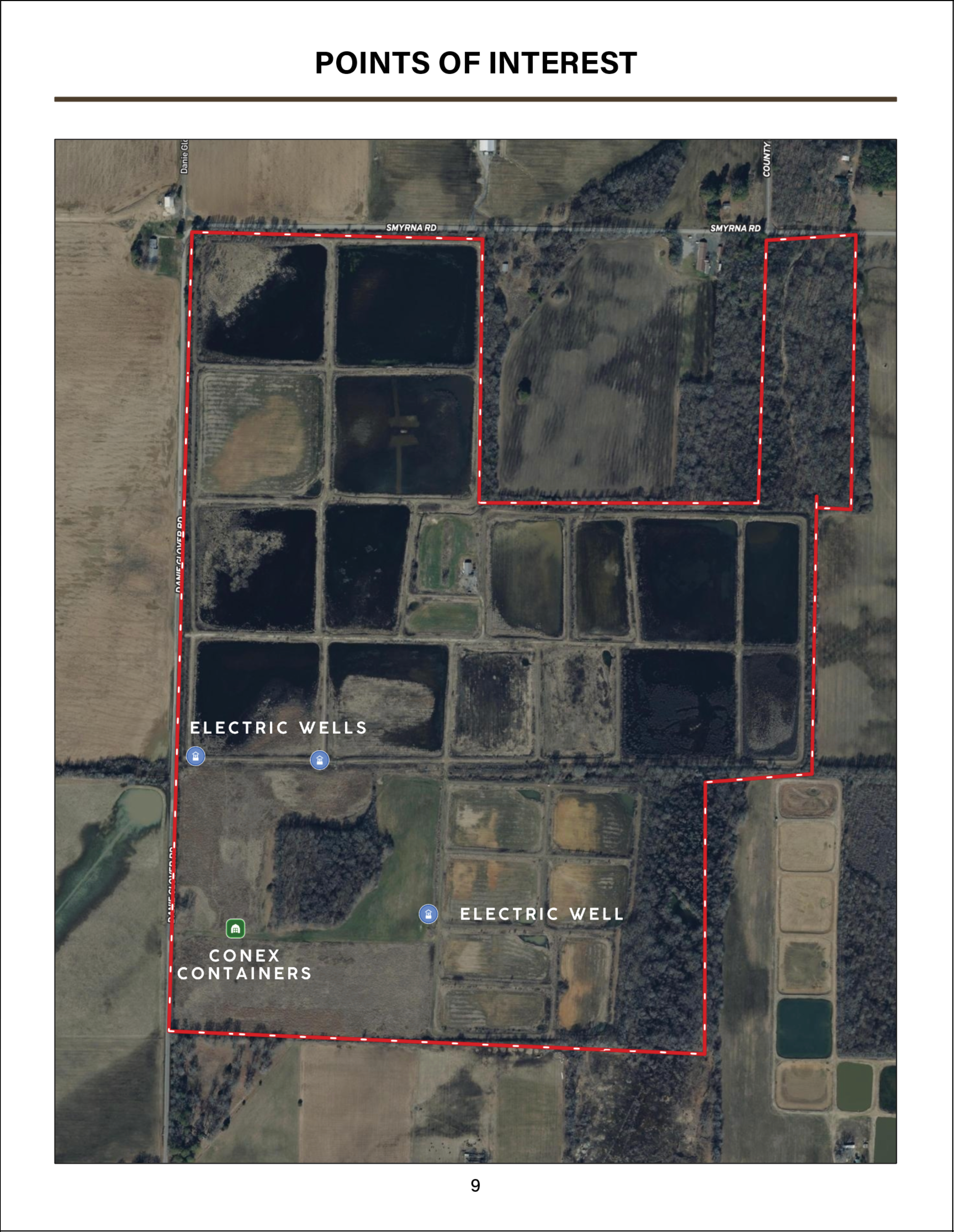
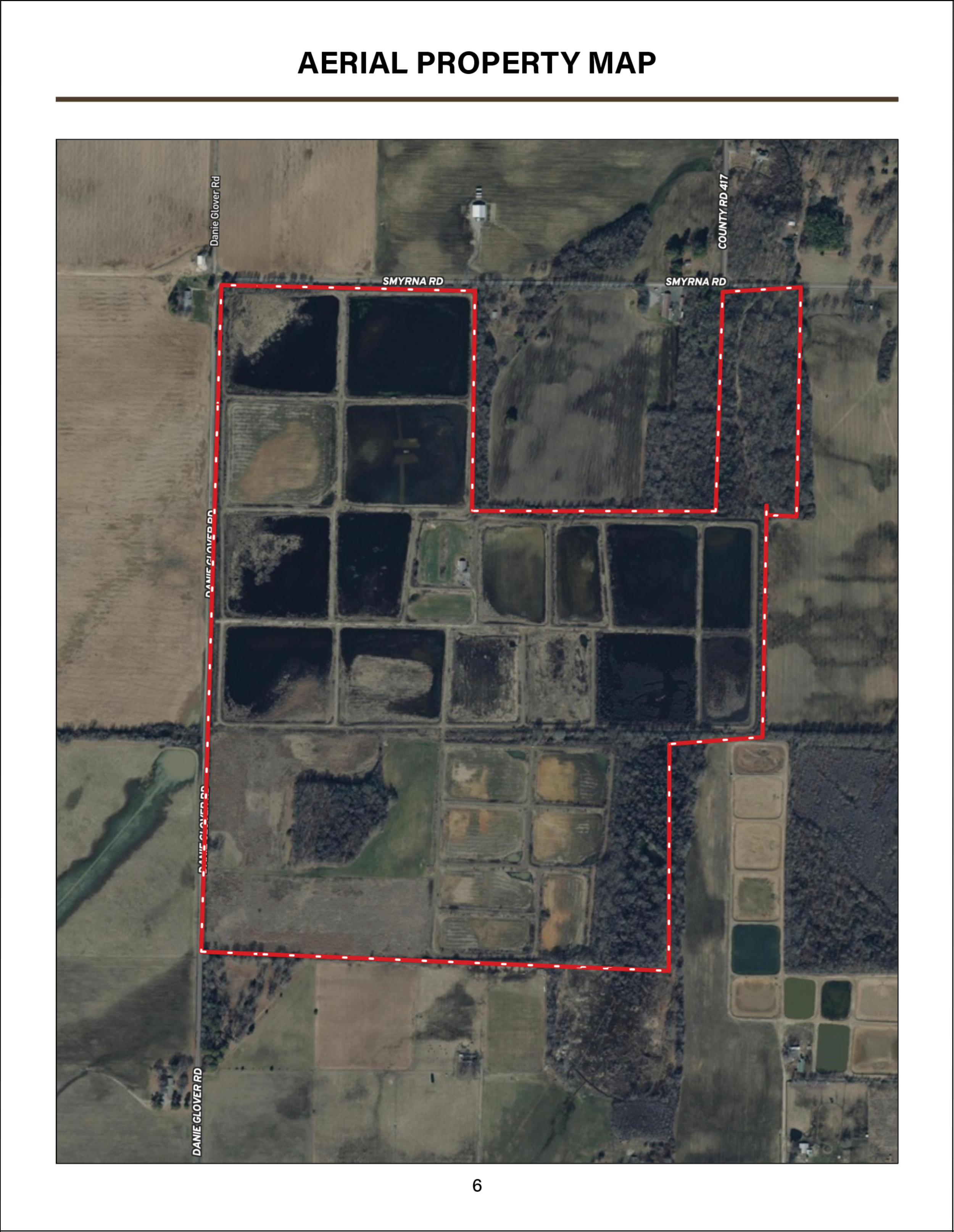
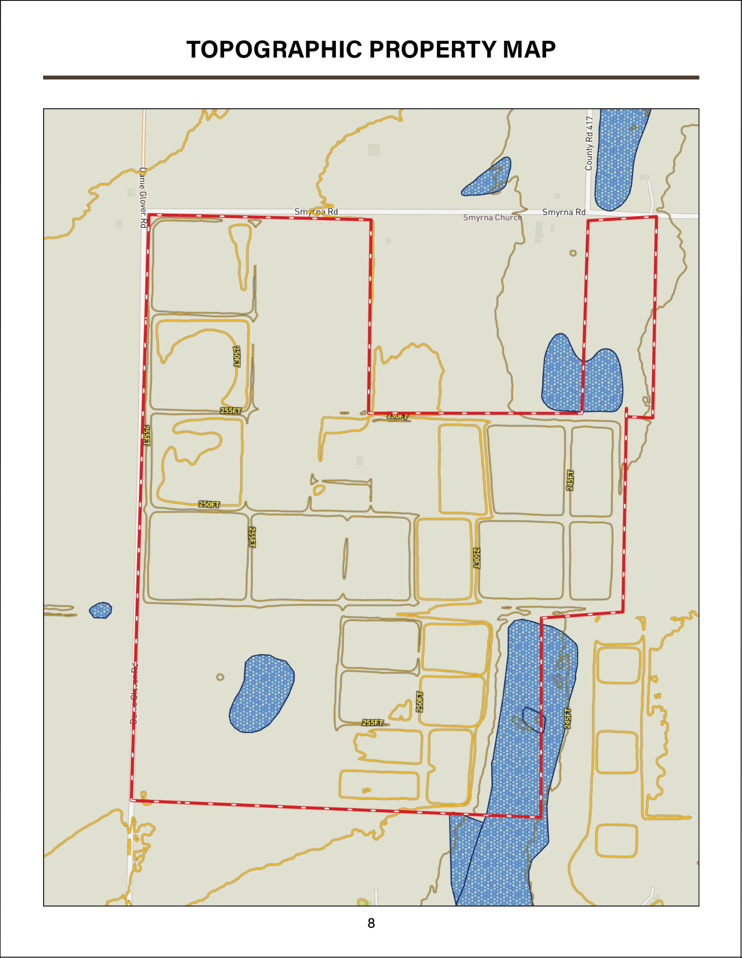
Approximately 200+/- acres are flood-ready, laid out across 25 managed duck ponds designed for feeding and resting habitat. Water is supplied by three electric irrigation wells and controlled through a system of standpipes, flash boards, and canal gates, allowing reliable water management throughout the season.
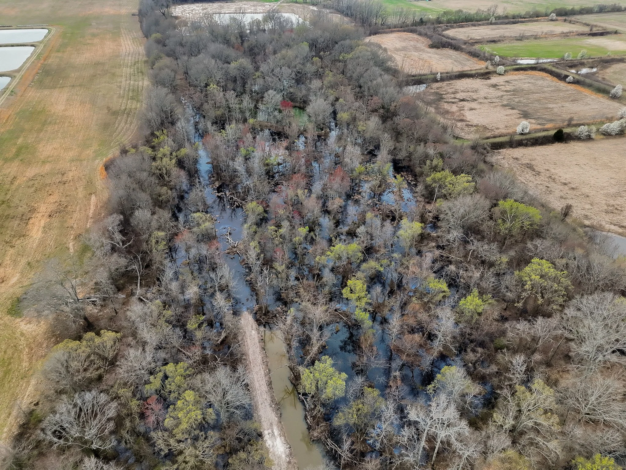
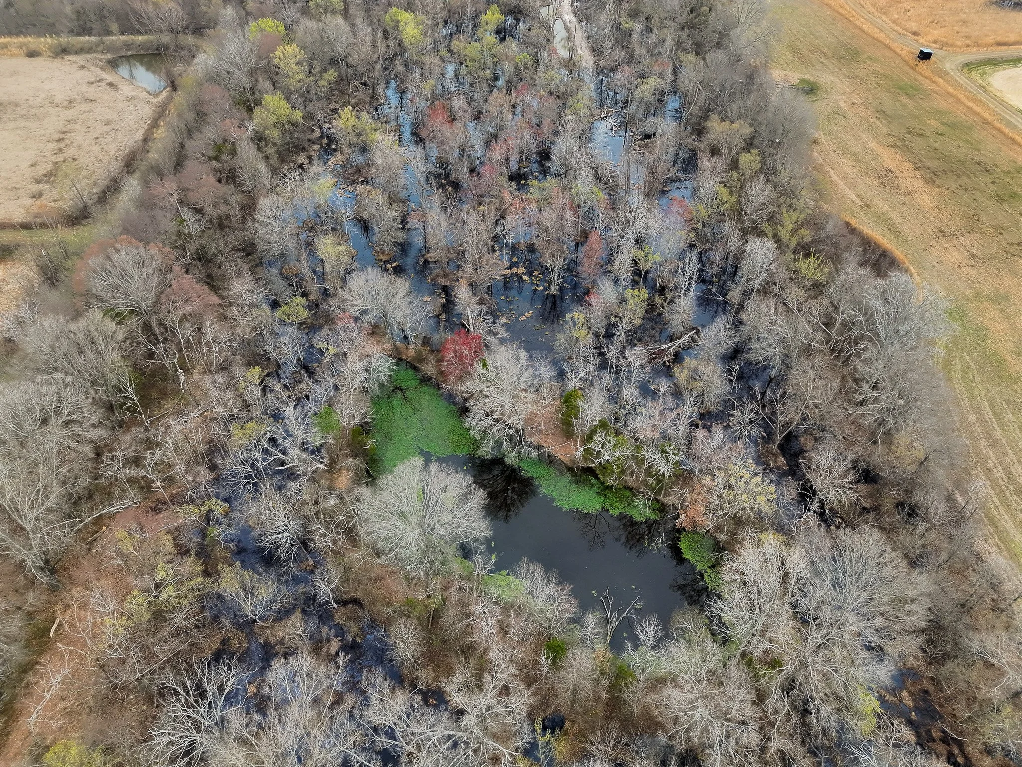
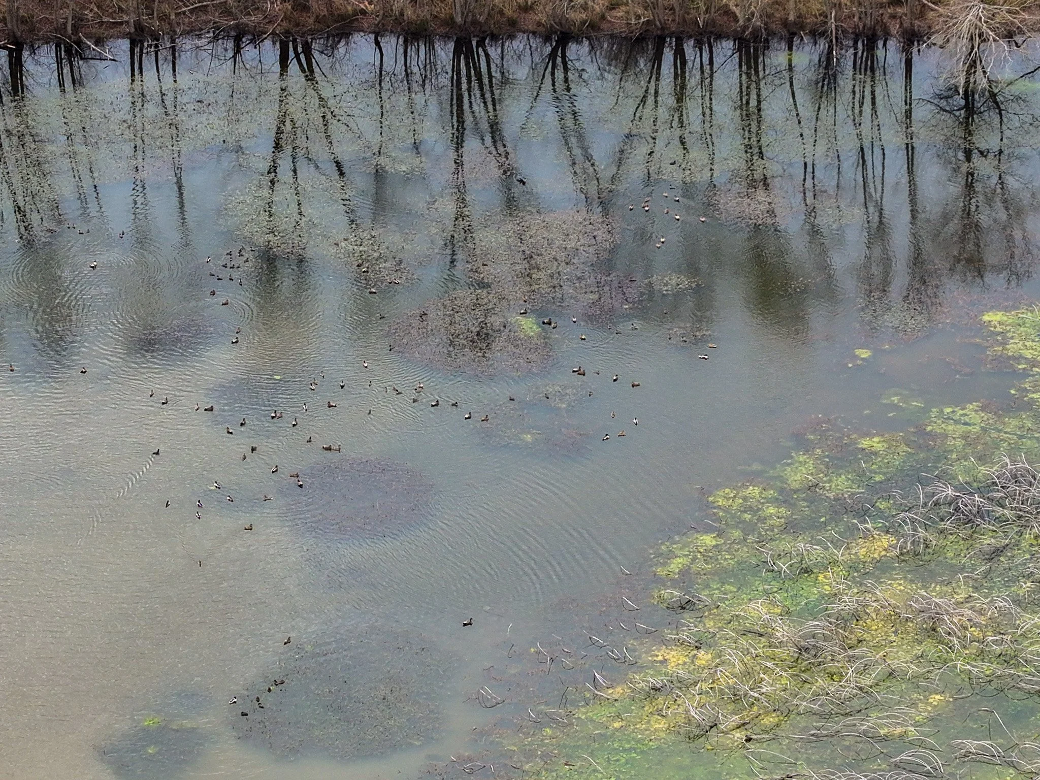
On the south end of the property, a small timber impoundment has shown consistent mallard use but has not yet been hunted, offering additional opportunity for future management.
Recorded harvest history includes:
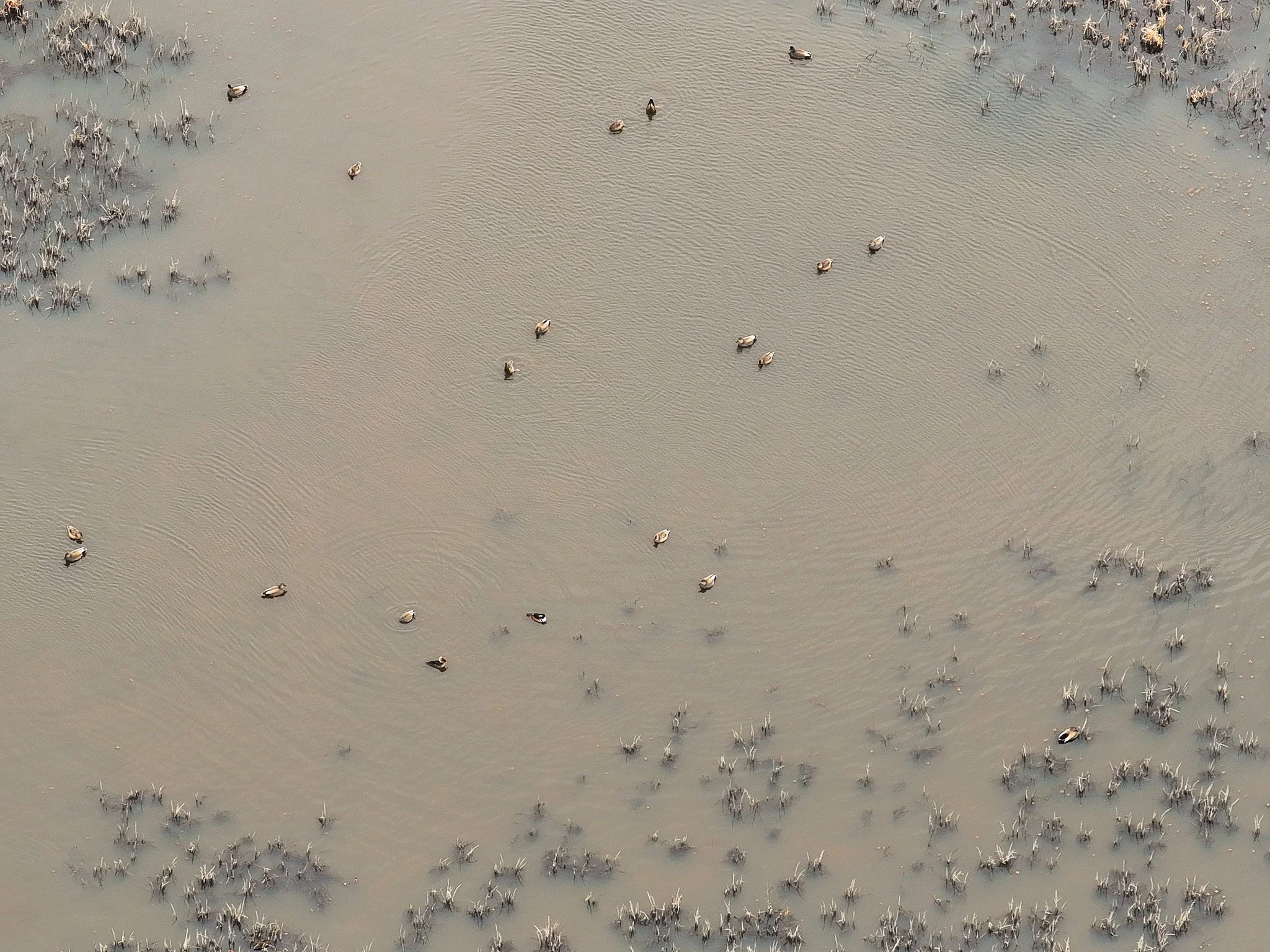
2023: ~800 ducks, ~100 early teal, ~300 dove, ~100 specklebelly geese
2024: ~650 ducks (including ~100 teal), ~300 dove, ~100 specks
2025: ~350 ducks harvested across 12 hunts and ~50 specks. Early teal season was not hunted this year. The dove opener produced 410 birds opening day, with another ~100 harvested the following week.
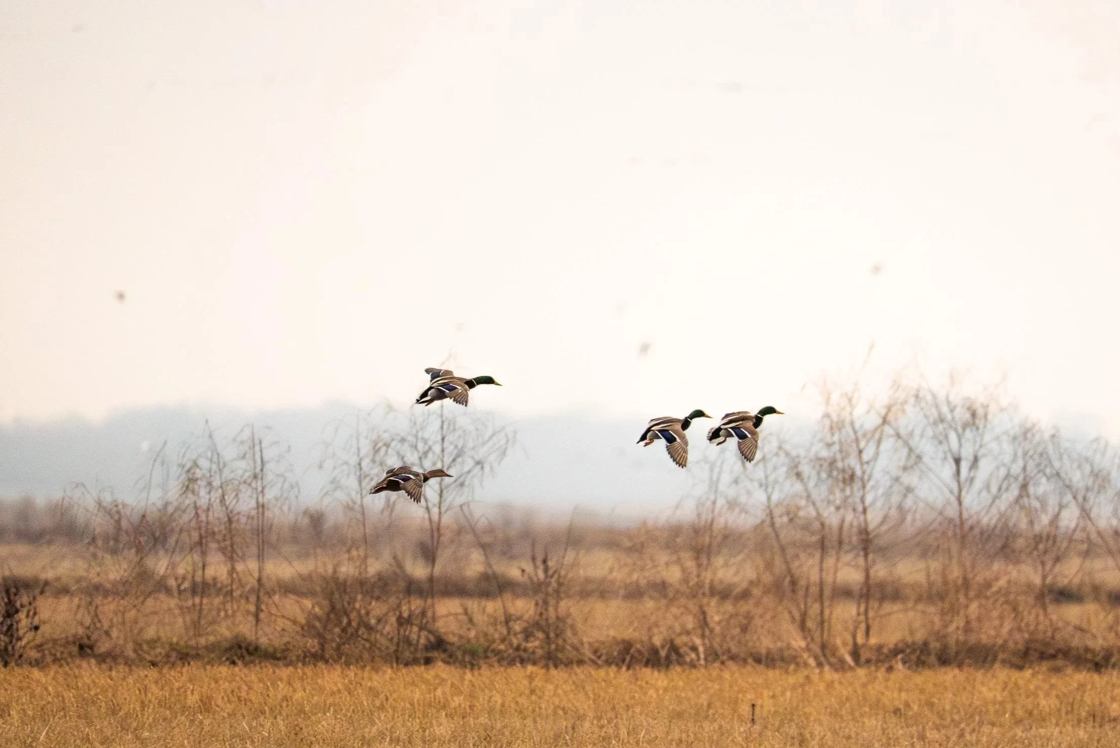
Waterfowl species taken over the years include mallards, green- and blue-winged teal, gadwall, wigeon, pintail, shovelers, ring-necked ducks, bluebills, redheads, canvasbacks, wood ducks, and buffleheads.
Habitat management has included aerial seeding of rice by A&M Flying Service on multiple ponds most summers, with rice left standing for waterfowl. Additional plantings have included corn and millet, along with managed moist-soil vegetation. The ponds support strong populations of aquatic invertebrates and crawfish, and shallow water areas regularly hold large numbers of crawfish.
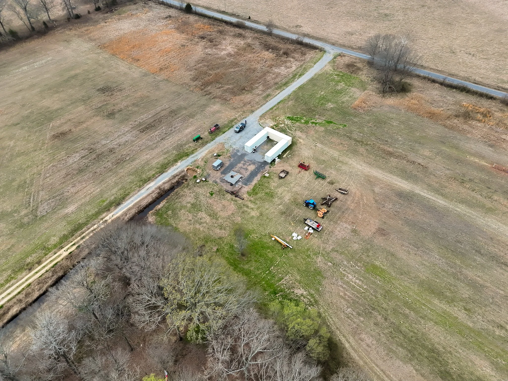
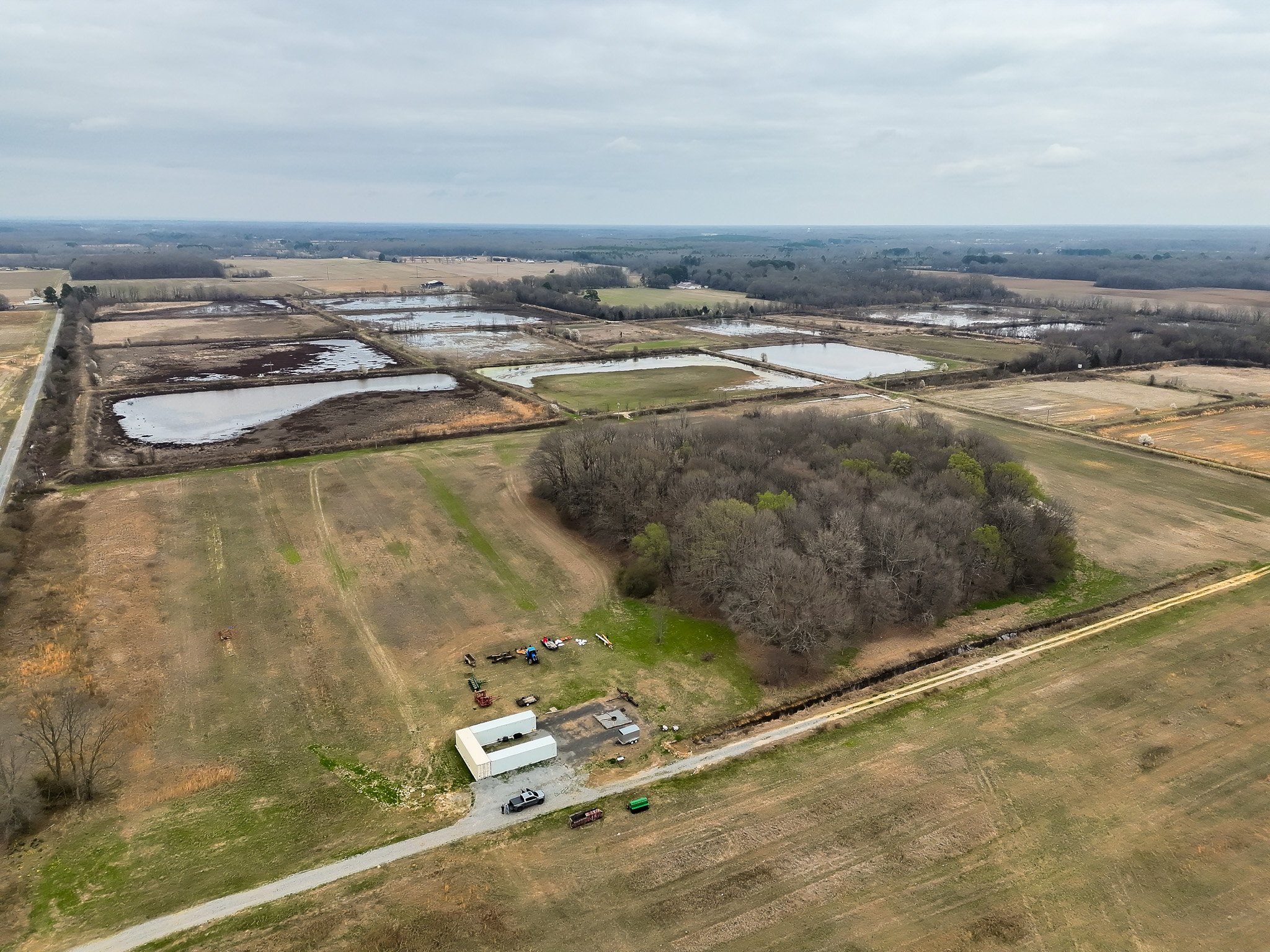
The property includes multiple existing blinds (wood, pit, and skid blinds), all-season gravel roads, and operational wells and water-control infrastructure, making the farm ready for immediate use. It also includes three Conex storage containers that convey with the property.
For more information and to schedule a tour, contact Joel Whicker, Principal, at Alluvial Land Company: 501-658-0658 or joel@alluvialland.com.
CONTACT

JOEL WHICKER
Principal
Contact Joel Whicker of Alluvial Land Company, LLC, for more information or to schedule a tour.
Disclaimer: Alluvial Land Company is the Exclusive Agent for the property described herein. This offering prospectus and all information contained herein is believed to be correct; however, we make no guarantee as to its accuracy. Prospective buyers are urged to inspect the property and perform their own independent due diligence. Alluvial Land Company and its agents assume no liability as to errors, omissions, or investment results. All information is approximate.
PROPERTY DETAILS
-
The land is situated in an outstanding duck hunting area and waterfowl hunting is available on the property via wood, pit, and skid blinds.
-
The property has excellent main access from the South West, and West ends of the farm. There is another potential access point on the North East corner of the farm, into the timber. Maintained levees run throughout the property, providing easy access to the ponds.
-
236.0± Total Acres
• 200.0± acres in flood-ready duck ponds
• Small timber impoundment -
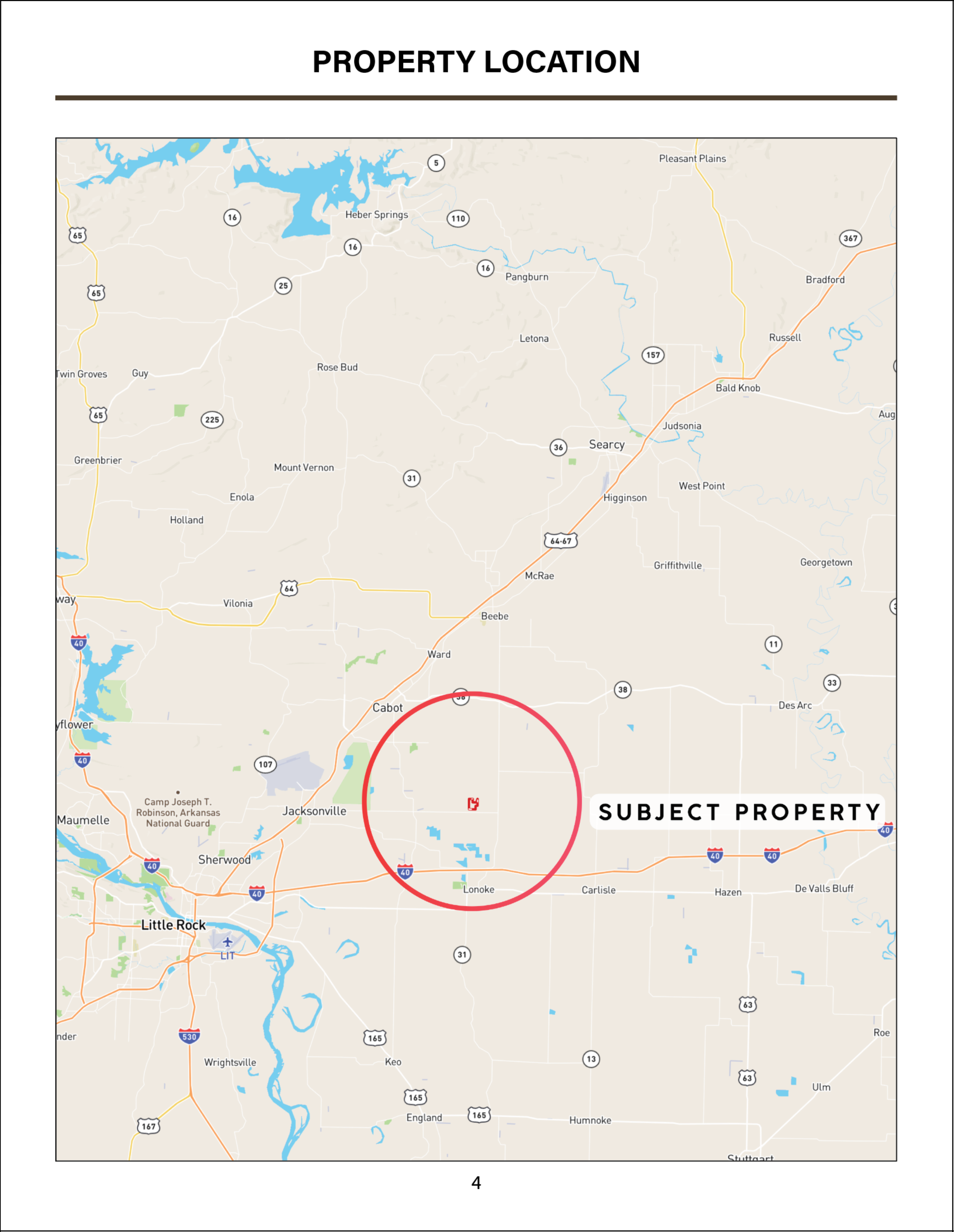
Lonoke County, Arkansas (Central Arkansas)
Coordinates: 34.86942° N, -91.91252° W
• Little Rock, AR 28 miles
• Scott, AR 21 miles
• Lonoke, AR 9 miles
• Jacksonville, AR 13 miles
• Cabot, AR 13 miles
• Beebe, AR 17 miles